


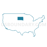
Sioux Falls City PUMA, South Dakota
About
Outline

Summary
| Unique Area Identifier | 193973 |
| Name | Sioux Falls City PUMA |
| State | South Dakota |
| Area (square miles) | 85.24 |
| Land Area (square miles) | 84.66 |
| Water Area (square miles) | 0.58 |
| % of Land Area | 99.32 |
| % of Water Area | 0.68 |
| Latitude of the Internal Point | 43.53259860 |
| Longtitude of the Internal Point | -96.73191470 |
Maps

Graphs
Select a template below for downloading or customizing gragh for Sioux Falls City PUMA, South Dakota


Neighbors
Neighoring Public Use Microdata Area (by Name) Neighboring Public Use Microdata Area on the Map
- Sioux, Clay, Dickinson, O'Brien, Lyon, Emmet, Palo Alto & Osceola Counties PUMA, IA
- Southeast South Dakota (Outside Sioux Falls City) PUMA, SD
Top 10 Neighboring County (by Population) Neighboring County on the Map
Top 10 Neighboring County Subdivision (by Population) Neighboring County Subdivision on the Map
- Sioux Falls city, Minnehaha County, SD (132,793)
- Sioux Falls city, Lincoln County, SD (21,095)
- Split Rock township, Minnehaha County, SD (3,248)
- Mapleton township, Minnehaha County, SD (2,188)
- Springdale township, Lincoln County, SD (2,108)
- Delapre township, Lincoln County, SD (1,805)
- Wayne township, Minnehaha County, SD (1,196)
- Benton township, Minnehaha County, SD (768)
- Sioux township, Lyon County, IA (311)
Top 10 Neighboring Place (by Population) Neighboring Place on the Map
Top 10 Neighboring Unified School District (by Population) Neighboring Unified School District on the Map
- Sioux Falls School District 49-5, SD (143,629)
- Brandon Valley School District 49-2, SD (16,026)
- Harrisburg School District 41-2, SD (15,963)
- West Central School District 49-7, SD (6,058)
- Lennox School District 41-4, SD (5,988)
- Canton School District 41-1, SD (5,582)
- Tea Area School District 41-5, SD (5,408)
- Tri-Valley School District 49-6, SD (5,024)
- West Lyon Community School District, IA (4,519)
Top 10 Neighboring State Legislative District Lower Chamber (by Population) Neighboring State Legislative District Lower Chamber on the Map
- State House District 10, SD (35,025)
- State House District 4, IA (30,923)
- State House District 11, SD (30,071)
- State House District 12, SD (29,821)
- State House District 9, SD (29,046)
- State House District 14, SD (24,426)
- State House District 13, SD (21,646)
- State House District 15, SD (21,169)
Top 10 Neighboring State Legislative District Upper Chamber (by Population) Neighboring State Legislative District Upper Chamber on the Map
- State Senate District 2, IA (60,664)
- State Senate District 10, SD (35,025)
- State Senate District 11, SD (30,071)
- State Senate District 12, SD (29,821)
- State Senate District 9, SD (29,046)
- State Senate District 14, SD (24,426)
- State Senate District 13, SD (21,646)
- State Senate District 15, SD (21,169)
Top 10 Neighboring 111th Congressional District (by Population) Neighboring 111th Congressional District on the Map
Top 10 Neighboring Census Tract (by Population) Neighboring Census Tract on the Map
- Census Tract 11.06, Minnehaha County, SD (9,727)
- Census Tract 101.04, Lincoln County, SD (9,364)
- Census Tract 101.02, Lincoln County, SD (6,734)
- Census Tract 18.03, Minnehaha County, SD (6,580)
- Census Tract 18.01, Minnehaha County, SD (6,493)
- Census Tract 11.05, Minnehaha County, SD (6,085)
- Census Tract 15, Minnehaha County, SD (5,648)
- Census Tract 9503, Lyon County, IA (5,465)
- Census Tract 101.03, Lincoln County, SD (5,465)
- Census Tract 106, Minnehaha County, SD (5,306)
Top 10 Neighboring 5-Digit ZIP Code Tabulation Area (by Population) Neighboring 5-Digit ZIP Code Tabulation Area on the Map
- 57106, SD (39,852)
- 57103, SD (34,480)
- 57104, SD (25,901)
- 57105, SD (22,268)
- 57108, SD (17,267)
- 57110, SD (12,309)
- 57005, SD (10,473)
- 57107, SD (8,044)
- 57032, SD (5,906)
- 57064, SD (5,072)